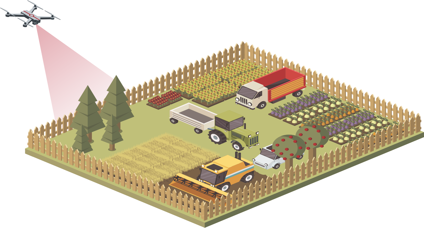
Agriculture
Site Safety Management:
Navigation Enhancement:
Site Safety Management
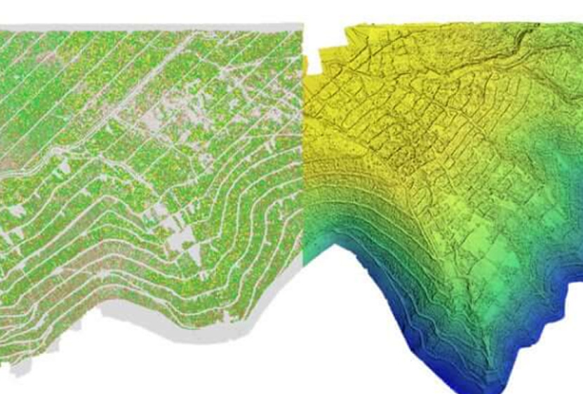
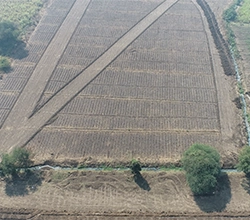
We generate a terrain/slope model of your field using an RGB sensor. This can be used as a tool for field traffic management and seeding decision-making. Research shows that utilising topographic maps generated by drones instead of ground-based approaches can result in up to 75% faster crop line planning.
For more precise and efficient cultivation, farm vehicles' navigation and autopilot systems can be updated with topographic maps of the fields. Later in the season, this data will also be required as the starting point for estimating crop heights.
UAVs can create accurate 3D maps and models of fields, pr oviding valuable insights into crop growth patterns, yield estimation, and spatial variability. This information aids in crop planning, decision-making, and optimising planting strategies for improved productivity.
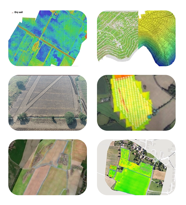
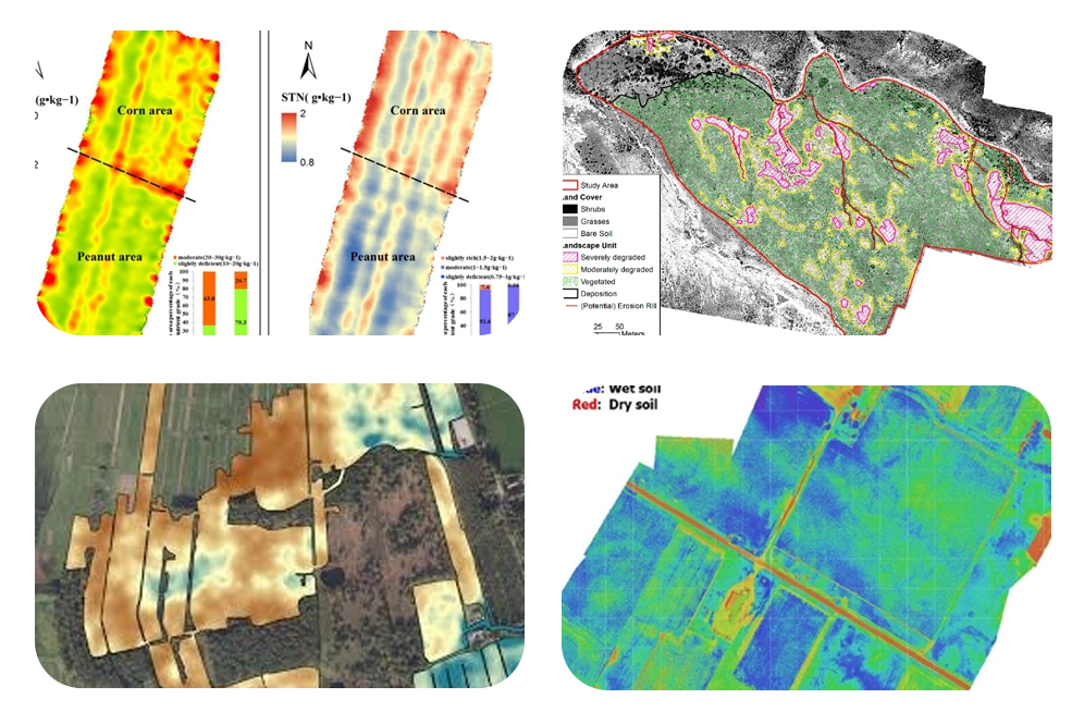
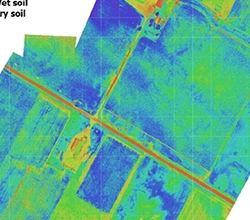
Drones offer the potential to improve soil monitoring by quickly collecting vital soil data. Using this technology eliminates discord about farmland states, allowing for better decision-making and less time spent on the field.
Drones equipped with an RGB sensor may collect soil data to identify compaction, erosion, and poaching on your farm. A NIR, or multispectral,thermal sensor can detect various soil types and moisture levels.
Utilizing hyperspectral sensors on drones enables precise species mapping by capturing spectral signatures. These sensors detect unique wavelengths reflected by various vegetation types, aiding in accurate species identification. Data processing techniques analyse spectral information to map species distribution and abundance. This approach offers efficient and non-invasive monitoring of ecosystems for biodiversity conservation and management.
Leveraging drone technology with hyperspectral sensors enhances ecological research and environmental monitoring capabilities.
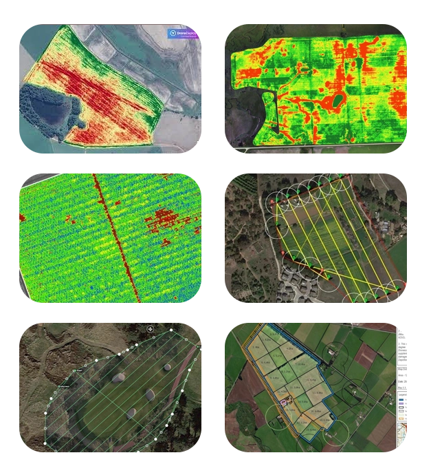
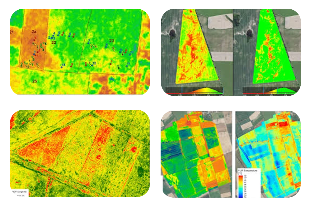
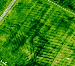
Our services, equipped with multispectral or thermal imaging sensors, can capture detailed aerial imagery of agricultural fields. This data helps farmers monitor crop health and detect pests, diseases, and nutrient deficiencies, allowing for timely intervention and optimised crop management practices. Our top-notch drones furnished with Multispectral camera sensors can identify disease and stress in the initial stages, sometimes before it is even evident from the ground or with standard colour cameras. Our drone surveys also provide real-time imagery of the fields for precision agriculture. The data obtained is processed and analysed during Irrigation Monitoring, Crop Health Monitoring, and other fundamental elements to encourage farmers to focus on treatment plans.
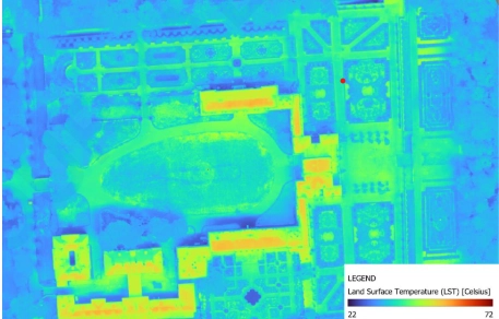
Using RGB sensors, crop variability can be assessed using the visual atmospheric resistance index (VARI); however, NIR and multispectral sensors are better at detecting and distinguishing crop stress using the Normalized Difference Vegetation Index (NDVI). Normalized Difference Red Edge (NDRE) is also often used in conjunction with multispectral data, offering more accurate crop health analysis in later growing stages. Thermal cameras can also be used to determine crop water stress by picking up variations in temperature within a crop, indicating irrigation issues.
Plant health algorithms explained
Healthy plants reflect light differently than unhealthy plants. This allows us to pick out plants that may be under stress from disease, pests, dehydration, etc. This is done by using plant health algorithms such as the Visual Atmospheric Resistance Index (VARI), Normalized Difference Vegetation Index (NDVI), and Normalized Difference Red Edge (NDRE). These algorithms are the most commonly used for agricultural purposes.
VARI was designed to be used with RGB sensors and measures how green an image is. Healthy plants tend to reflect more green light and less red light. This allows VARI to highlight areas where less green light is being reflected, suggesting plant stress.
NDVI was designed to be used with NIR and multispectral cameras and measures the ratio between NIR and red being reflected from a plant. Plants that are healthy should be absorbing red light for photosynthesis and reflecting more NIR than stressed plants, allowing for this algorithm to indicate the health of plants.
NDRE was designed to be used as an index for multispectral cameras and measures the ratio between NIR and red edge being reflected from a plant. This algorithm is typically better in the later growth stages of crops, as Red edge is absorbed less than red light by surface leaves, giving a better overview of plant health when plant canopies are dense. NDRE gives a picture of leaf chlorophyll content, which is a good indicator of foliar nitrogen levels
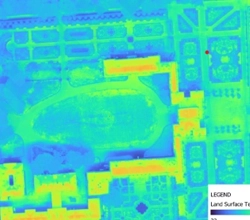
DATAPKT AVIATION stands at the forefront of providing comprehensive aerial surveys tailored specifically for irrigation planning, monitoring, and the detection of irrigation-related issues. Our broad range of services primarily focuses on land and soil-related aspects crucial for efficient water management in agriculture. Through the utilization of advanced aerial imaging technology equipped with multispectral, hyperspectral, LiDAR, and thermal sensors, coupled with cutting-edge analytics, we deliver unparalleled insights to optimize irrigation practices.
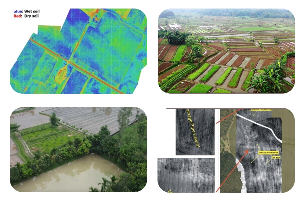
One key service offered by DATAPKT AVIATION is soil moisture estimation. By capturing high-resolution aerial imagery and utilizing advanced sensors, we accurately assess soil moisture levels across agricultural fields. This information enables farmers to optimize irrigation schedules, preventing both water waste and soil water stress, ultimately enhancing crop yield and quality.
At DATAPKT AVIATION, we understand the critical importance of efficient water management in agriculture. By harnessing the power of aerial imaging and advanced sensors, along with our extensive expertise in UAV technology, we empower farmers and water resource managers to make informed decisions that maximize productivity while minimizing environmental impact. Our commitment to innovation and excellence ensures that we deliver tailored solutions that meet the unique needs of each client, driving sustainable growth and resilience in agriculture and water management sectors. Our services are outlined in the following sections:
Our unmanned aerial vehicle services offer real-time data and insights that can be implemented in action, allowing for more informed decisions that improve irrigation operations.
Site Safety Management
We provide a detailed survey and 3D & 2D maps of the area around the water bodies, estimate the water coverage, and analyse the need for water to irrigate that part of the ground. We utilise the power of specialised software that processes the acquired video and data in order to provide accurate measurements of water volumes and surface areas. This allows us to estimate the amount of water covered. The management of water resources would benefit significantly from this information.
The following is a list of some of the most important uses of our drone-based water mapping and estimating services:
Bathymetric Mapping
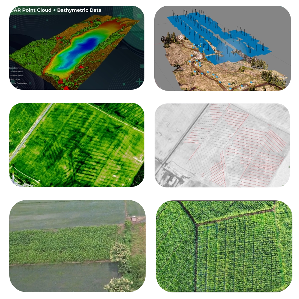
We provide bathymetric mapping to calculate the depths and volumes of rivers, lakes, and other water bodies. A bathymetric sensor converts sound into image format.
Soil moisture estimation
Our drone services, which are coupled with thermal sensors and remote sensing capabilities, highlight areas that receive insufficient or excessive moisture. These surveys provide data for precision irrigation systems.
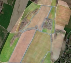
Drainage planning
The topography of fields in RGB imagery helps farmers arrange and segregate crops to improve drainage, follow natural land runoff, and avoid waterlogging.
Site suitability for water storage
By estimating slopes,drainage density, land use, and land cover, we are able to analyse the area for water storage.
Watershed area management
Our services for watershed project management include runoff estimates and water tables that are spatiotemporally correct. This integrates with complete 3D models (survey and mapping) that analyse riverbank migration, erosion, and wetland state (regression or development).
Drones are able to complete tasks such as accurate planning and surveying of all construction, as well as the first mapping of drainage lines and contours. They provide more assistance in slope analysis. This is all integrated with GIS and real-time weather data to forecast the amount of water that can be effectively gathered and used.
We provide services to monitor the infrastructure related to the irrigation management system.
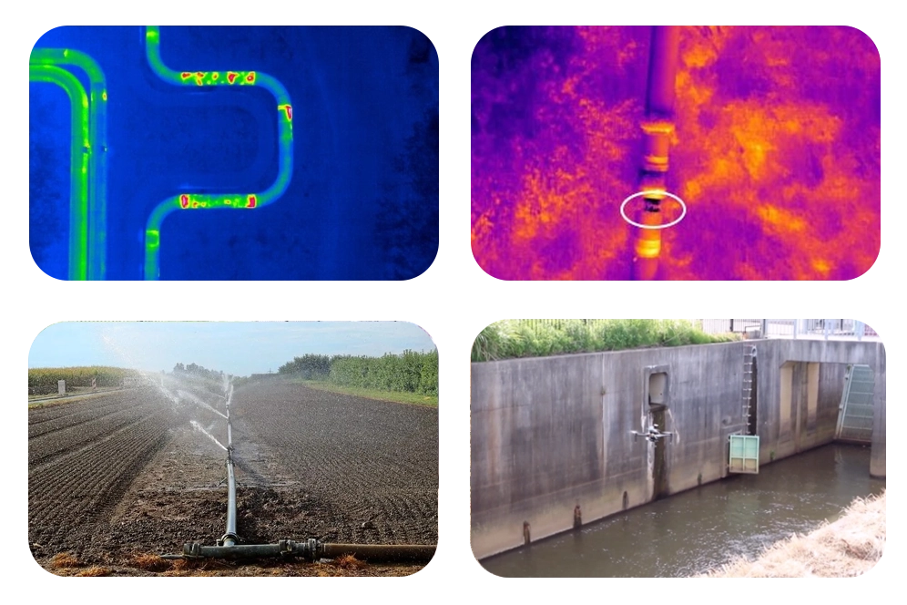
Problem detection
Leakes and clogged pipes are the primary problems in irrigation plans. We estimate these problems using thermal and multispectral sensors.
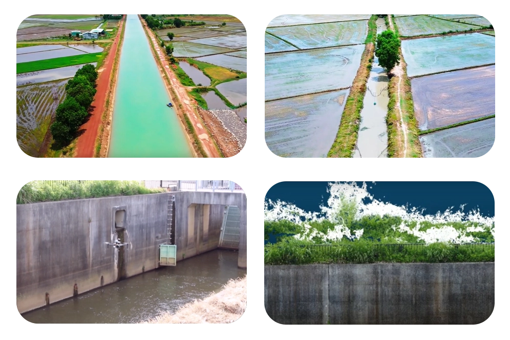
Canal mapping
We offer aerial imagery from drone surveys to produce high-resolution and accurate orthophotos, digital elevation models (DEM), digital terrain models (DTM), and contour maps.
The data is used to simulate models and analyse water movement so that canals can be designed appropriately, so this data is really helpful for Canal route alignment survey and Surface models of linking canal
Canal crack detection [3D model of canal walls]
We provide a 3D model of canal walls that gives a total inspection of the canal walls and their damages.
Canal water spread estimation
With thermal sensors, we estimate the water spread of the canal, and this data can be used for the wellness of land with insufficient water or inessential.
Inspection of water theft
Our high-resolution aerial imagery and videos make us strongly able to inspect the water theft all around the canals and monitor the area.
Tracking the progress of ongoing projects
Our high-resolution data can capture images of the construction site from various angles. These images can be used to create 3D models of the site, which can be used to monitor site progress, identify any potential issues, and ensure that our teams are working efficiently and effectively.

Visual inspections are the most common technique used to discover leaks throughout the water pipeline system. In this process,our trained professionals visually inspect pipelines, valves, and other components of the system to look for any indications of damage or leakage. For the purpose of conducting visual inspections of water pipeline networks, drones that are fitted with high-resolution cameras are able to supply drones with real-time aerial imagery.
This makes it possible to immediately discover any indicators of structural deterioration or leakage, such as cracks, corrosion, or misalignments in the body of the structure. Our drone imagery and videos offer:
In multispectral imaging, we capture photos at a variety of wavelengths in order to analyse different aspects of a scene, such as the plants, the soil, and the water, among other things.
The following are some of the ways in which drones that are equipped with multispectral sensors can assist us in detecting water leaks, hydrological mapping, and surveying:
Ultimately, we are able to conserve vital water resources and minimise damage to infrastructure by utilising these cutting-edge drone technologies, which allow us to detect, monitor, and correct leaks in water distribution systems in an efficient and accurate manner.
With the use of laser-based remote sensing, Lidar (Light Detection and Ranging) technology can produce intricate 3D maps of a water distribution system.
A combination of drones and Lidar technology allows us to:
Infrared cameras are utilised by thermal imaging technology in order to identify temperature changes on the surfaces of water pipelines and the ground.
If drones equipped with thermal imaging capabilities are flown over the water distribution system, the following will occur:
High-resolution aerial photographs and videos provide comprehensive views of crop fields, allowing farmers to monitor crop health, detect pest infestations, and assess overall field conditions.
Stitched together from hundreds or thousands of individual aerial images, orthomosaic maps offer accurate representations of farm fields, aiding in precise measurement, planning, and analysis.
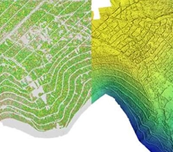
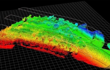
we generate Detailed three-dimensional models of farmland from drone survey data, enabling farmers to visualize terrain, elevation changes, and crop distribution, facilitating better land management decisions.
we collect data on soil properties, moisture levels, and nutrient content, helping farmers to optimize irrigation, fertilization, and soil management practices for improved crop yields and sustainability.
Multispectral or thermal sensors capture data related to crop health, identifying areas of stress, disease, or nutrient deficiencies early on, allowing for targeted interventions and optimized crop management strategies.
By integrating drone-derived data with GPS technology and farm machinery, we implement precision agriculture techniques such as variable rate application of inputs, minimizing costs and environmental impact while maximizing crop productivity.
Over 5000 hectares of farmland surveyed and optimised.
In just four years, we've covered vast expanses of agricultural land, aiding farmers and land managers in enhancing productivity and sustainability.
With a team of experienced drone pilots and GIS engineers, we can survey over 100 hectares of farmland per day.Our high-end survey drones and efficient workflows ensure swift data collection without compromising on accuracy.
Our dedicated team of GIS experts works tirelessly to process and analyze drone survey data promptly.Fast data delivery ensures that farmers and agricultural stakeholders receive actionable insights in a timely manner, enabling informed decision-making.
Our drone-based surveys offer up to 70% greater accuracy compared to traditional methods.By leveraging cutting-edge technology and precise data collection techniques, we provide farmers with reliable information for optimising crop planning, irrigation, and resource allocation.