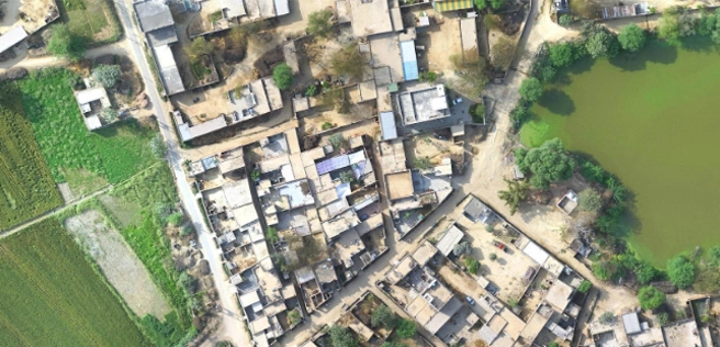
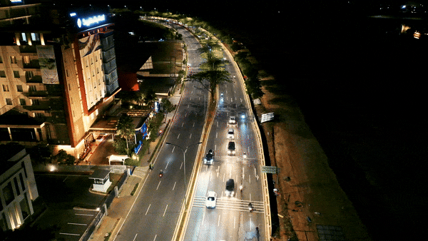
Cinematography

Aerial photography

Our talented team of drone cinematographers enables us to provide clients with stunning, high-resolution aerial photographs of their properties and assets. Each shot is meticulously customized by our experts to meet the unique needs of our clients, whether they require images for residential properties or resort hotels. We place a strong emphasis on creativity and maintain a thorough understanding of our clients' objectives. This allows our pilots to consistently exceed expectations, delivering exceptional results.

By combining technical expertise with a keen eye for detail, we ensure that every project captures the essence of the subject in a way that aligns perfectly with our clients' vision. Our commitment to excellence and client satisfaction drives us to produce remarkable aerial imagery that stands out for its quality and precision. Whether for marketing, documentation, or personal enjoyment, our drone photography services provide invaluable perspectives that enhance the visual appeal and value of any property.

Aerial videography

Our area of expertise is the development of exceptional 4K, high-quality drone videos that are customized to meet the individual requirements of our clients. Our professional drones for cinematography are professionally used by our skilled drone cinematographers to produce outstanding videographs. Then, with much attention to detail, our team of dedicated video editors enhances these clips to make them visually intriguing and visually appealing. Our ultimate goal is to use the power of amazing aerial cinematography to help our businesses increase their consumer base and revenue.

  • Real Estate Marketing
  • Construction Progress Monitoring
  • Site Surveying and Inspection

Our Features

5x Faster Delivery

Our dedicated team of GIS experts works tirelessly to swiftly process and analyze drone survey data, ensuring prompt delivery, often ahead of schedule.

99% Accurate Measurement

We achieve up to 99% accuracy in our results, employing advanced machine learning techniques for precise yield estimation, volumetric measurements, and more.

Team of Experts

Our seasoned team of GIS engineers, drone pilots, and software engineers operates round-the-clock, delivering unparalleled service excellence.

Advanced Equipment

Equipped with cutting-edge drones featuring high-resolution sensors, our surveying capabilities are bolstered by both DJI models and custom-made drones.