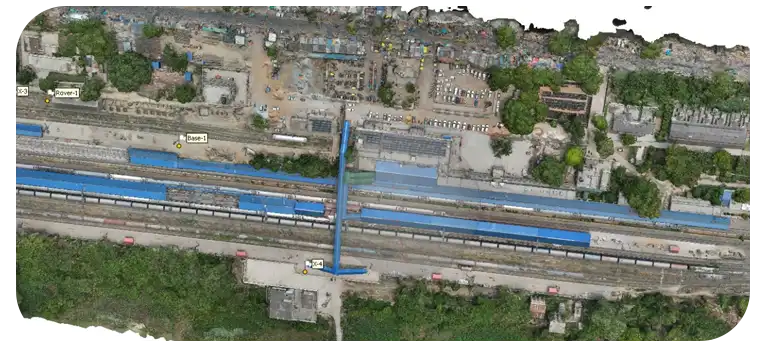
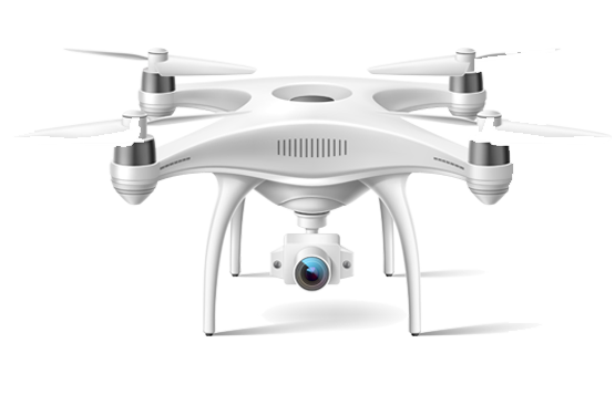
Photogrammetry

At DATAPKT Aviation, we help with the following photogrammetry steps:

Data Acquisition

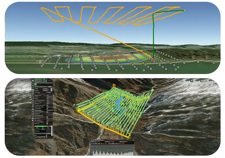
Planning and Preparation

  • Define project objectives and requirements.
  • Identify survey area and assess potential obstacles.
  • Determine optimal flight path and altitude.
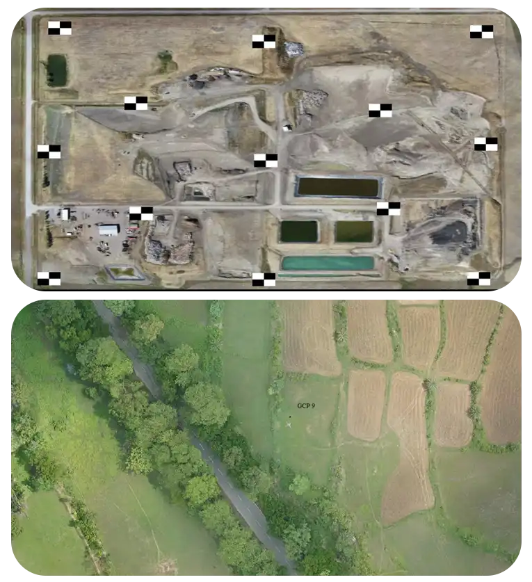
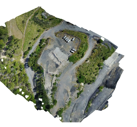
  • Ensure 80% image overlap for accurate orthophoto creation.
  • Check weather conditions and obtain necessary permits.

Equipment Setup

  • Ensure drone and camera are in good working condition.
  • Calibrate drone sensors and cameras.
  • Install and configure additional hardware (e.g., GPS).

Camera Model Optimization

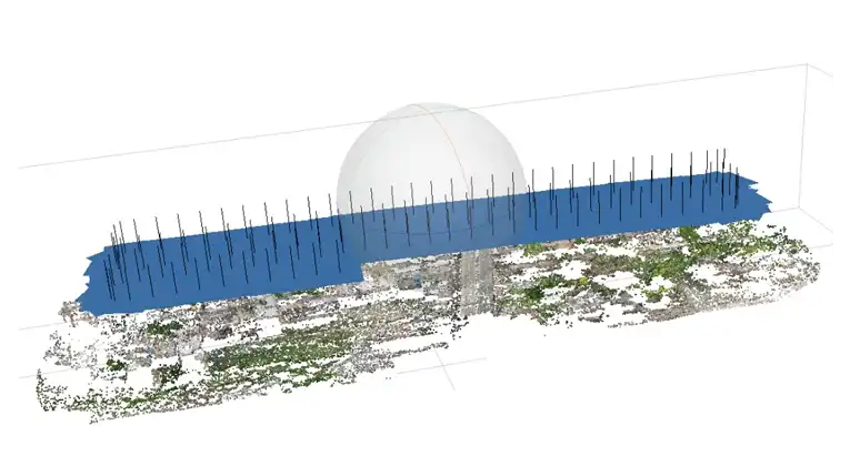
Camera calibration calculates camera specifications using photos of a 3D object with a geometrical pattern (e.g., checkerboard). Calibration types include Full, Field, Self, and Auto.

  • Full calibration sets up a specific camera calibration project.
  • Field calibration optimizes the camera during normal project processing.
  • Self-calibration adjusts camera parameters for each photo individually.
  • Auto calibration integrates with Smart Orientation for field calibration.

GCP (Ground control points)

Ground control points (or GCPs) are known-coordinated places on the ground. GCPs are points that a surveyor can precisely locate in an aerial mapping survey, allowing enormous regions to be correctly mapped with just a few known coordinates.

Anything that may be clearly identified in the photos can be used as a ground control point. They usually resemble little checkerboard pieces. The form eliminates any doubt about where a ground control point is.


Is it always necessary to use GCP?

GCPs have long been used in aerial mapping operations. However, as new technologies are introduced to the market, this is changing.

Ground control points do not significantly increase accuracy when utilising an RTK or PPK capable drone.

We always advocate using GCPs if your drone does not have RTK or PPK capability.

While skipping ground control points may produce absolutely acceptable results, your reconstruction may lack the necessary scale, orientation, or absolute location data. The GCPs, RTK, and PPK geotags can aid in the verification of the reconstruction's correctness.


The difference between GCP, Automatic and Manual tie points

GCP are known as Ground control points. These are known coordinates points on ground & can be known using instruments like DGPS & Total-Station.

Automatic ties are points that appear in numerous photographs. This is something that the program can detect. They are frequently used as common spots in picture stitching.

Any immediately identifiable place that appears in several photos, such as the corner of a building or a road, can be used as a manual tie point.

Manual tie points can assist in enhancing a project's relative accuracy, but they can't help with absolute precision because their location in space isn't known.

Flight Execution

  • Conduct a pre-flight check to verify all systems are functioning correctly.
  • Launch the drone and follow the planned flight path, adjusting altitude and camera settings as needed.
  • Capture overlapping aerial images with sufficient ground coverage and detail.
  • Maintain communication and monitor the drone's position and battery life throughout the flight.
  • Ensure the drone returns to the home point or a safe landing location with ample battery reserve.
  • Post-flight inspection to assess drone condition and review any captured data for quality.
  • Transfer and back up all aerial images and data to a secure storage location.
  • Analyze the captured images to create a detailed map or 3D model of the surveyed area.
  • Download and back up all captured images and flight data immediately after landing.
  • Regularly check the weather conditions and adjust the flight plan if necessary.

Data Processing

  • Transfer the captured imagery to a computer or processing device.
  • Use specialized photogrammetry software to stitch together the individual images into a cohesive mosaic.
  • Apply algorithms to triangulate image features and generate a dense point cloud representing the surveyed area.
  • Generate orthomosaics, digital surface models (DSMs), and other derived products from the processed data.
  • Validate the accuracy of the generated models by comparing them with ground control points (GCPs) or known reference data.
  • Perform quality checks on the orthomosaics and DSMs to identify and correct any artifacts or inconsistencies.
  • Export the processed data into various formats suitable for different applications and software platforms.
  • Integrate the geospatial data with GIS software for further analysis and visualization.

Data Quality Control and Analysis

  • Validate the accuracy and completeness of the generated 3D models and maps.
  • Conduct any necessary adjustments or corrections to improve the quality of the data.
  • Perform measurements, analysis, and interpretation of the photogrammetric outputs to extract relevant information.
  • Share the validated models and maps with stakeholders for feedback and further insights.
  • Use the extracted information to support decision-making processes in relevant projects or applications.
  • Document the methodologies and workflows used in the photogrammetric process for reproducibility and future reference.
  • Train team members or clients on how to utilize the photogrammetric data effectively.
  • Stay updated with advancements in photogrammetry techniques and software to continuously improve the quality and efficiency of data processing.

Deliverables

Orthomosaic map

Drone photographs are corrected for distortion and seamlessly merged during post-processing to produce a remarkably precise orthomosaic map. Every pixel on this map includes high 2D geographic data (X, Y), allowing exact measurements such as horizontal distances and surface areas to be collected directly.

3D Point Cloud

Drone images processed to create dense point clouds yield precise models with geographic coordinates (X, Y, Z) and color data for accurate measurements of horizontal and vertical lengths, areas, and volumes. These point clouds offer highly detailed representations, enhancing measurement precision in various applications.

DSM

A DSM captures ‘the natural and built features’ on the Earth’s surface. DSMs represent the bare- earth and all of its above-ground features. Drone images can also be used to create DSM models of the area. Each pixel contains 2D information (X, Y) and the altitude (Z value) of the highest point for this position.

DTM

DTM’s (Digital Terrain Model) are detected using aerial photography at low heights with a geometrically calibrated camera. This enables the drone to obtain all the heights of the surveyed terrain. In these models, each pixel stores 2.5D information, including the X, Y, and Z values corresponding to the highest altitude.

Contour map

By utilizing a contour line map created from a DTM or DSM model with specific contour intervals, we can gain a deeper understanding of the area photographed by the drone. The contour intervals can be adjusted according to the project's requirements, enhancing the detail and accuracy of the analysis.

3D Textured Mash

A 3D textured mesh generated from drone imagery offers a detailed and accurate representation of the site's surfaces, walls, and edges. This model enhances understanding by providing a comprehensive view of the area, essential for precise analysis and project planning.

Our Features

5x Faster Delivery

Our dedicated team of GIS experts works tirelessly to swiftly process and analyze drone survey data, ensuring prompt delivery, often ahead of schedule.

99% Accurate Measurement

We achieve up to 99% accuracy in our results, employing advanced machine learning techniques for precise yield estimation, volumetric measurements, and more.

Team of Experts

Our seasoned team of GIS engineers, drone pilots, and software engineers operates round-the-clock, delivering unparalleled service excellence.

Advanced Equipment

Equipped with cutting-edge drones featuring high-resolution sensors, our surveying capabilities are bolstered by both DJI models and custom-made drones.