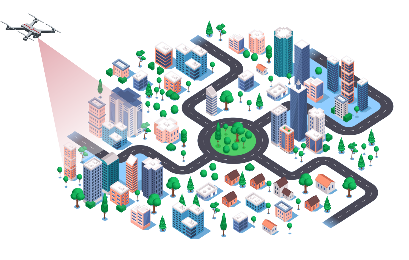
Urban Planning And Construction
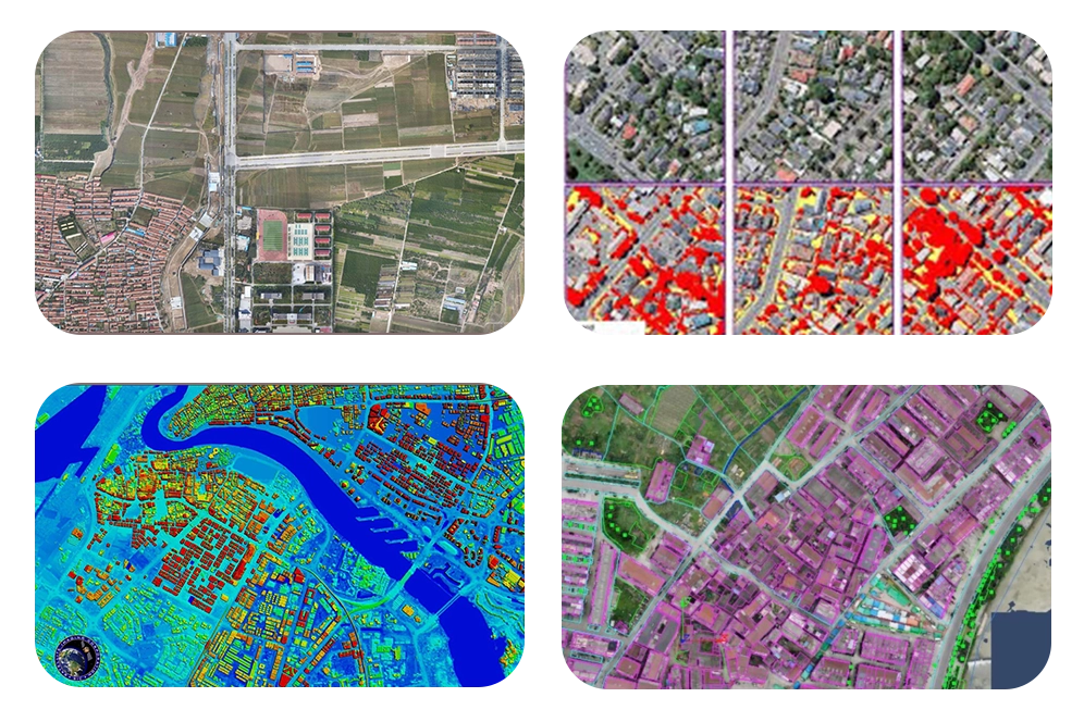
We offer services equipped with high-resolution sensors and camera technology to swiftly gather aerial photographs and geographic information. With this data, we generate precise 3D models, land use and land cover maps,urban sprawl, determine infrastructure requirements, and evaluate the features of the terrain.
We also assist in urban planning to give planners more precise and thorough terrain models and 3D reconstructions, which will aid in their understanding of the area's topography, vegetation, building structures, etc. Drones can give architects and designers a better understanding of project sites and a source of inspiration for their work by taking panoramic pictures and producing aerial films.
We provide a site monitoring service in which drones fly regularly and take real-time photographs and videos of construction sites. This enables project teams to monitor building progress, work quality, and address possible concerns on time. The drone's bird's-eye view allows monitoring workers to more fully analyse the structure and overall status of the building, ensuring the project's quality and safety.
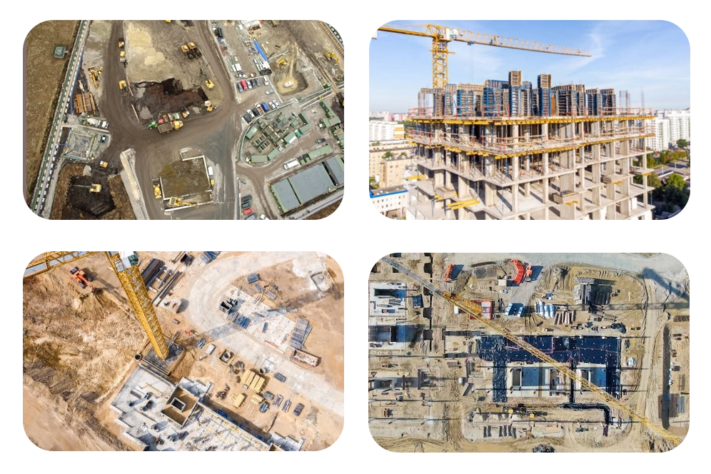
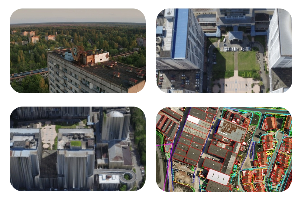
Traditional building inspections and maintenance are time-consuming and risky. Our drone service performs external inspections and captures high-definition photographs or videos without requiring direct human access to hazardous locations. Our non-contact inspection technology increases not just safety but also efficiency and accuracy. Drones can also be used to monitor the structural health of buildings, providing valuable information for maintenance planning.
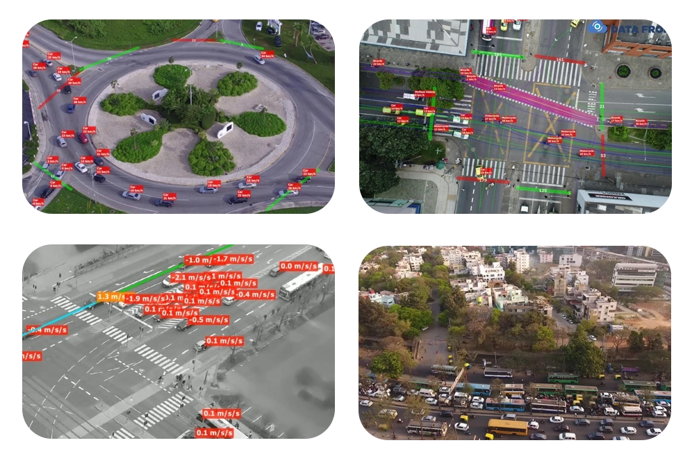
Expanding infrastructure alternatives is one of the feasible methods of transportation planning. Traditional traffic monitoring technologies use tower-mounted cameras and sensors, but they need to be done more quickly. They also do not account for less-travelled routes. In comparison, our drone services are faster and more efficient in a variety of ways.
Our urban design and transportation planning service is most useful when conducting real-time observations during rush hour. Planners can use their data to make adjustments that increase rider and pedestrian safety. We offer drone imagery and data to help urban planners create accurate models and simulations of suggested modifications. Our drone-generated data frequently outperforms traditional 2D maps in quality.
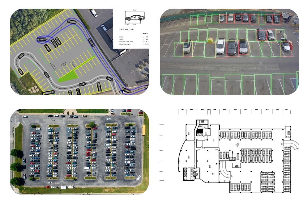
Parking space usage can be inefficient and disrupt traffic flow, which is crucial in metropolitan areas. We can help city planners and architects make more informed decisions about urban design and transportation planning. We offer real-time aerial imagery, which effective software and algorithms may combine into virtual models. These models can take into account not only parking occupancy but also date and time.
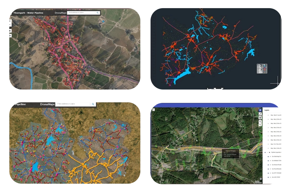
With drones, we provide swift, accurate water pipeline mapping. Equipped with high-resolution cameras and LiDAR, drones capture detailed aerial imagery and topographic data, aiding in issue identification and maintenance optimization. Access to remote terrain enables thorough inspections without disruption. Integrating our services enhances efficiency, reduces costs, and improves water system management.
We offer services equipped with advanced sensors, Sewage mapping involves capturing aerial imagery and data to identify sewage infrastructure, monitor wastewater flow, detect leaks, and assess the condition of sewage systems. This data aids urban planners and environmental agencies in optimising sewage management, prioritising maintenance efforts, and mitigating environmental risks. By providing detailed insights into sewage networks and potential issues, our drone-based mapping enhances the efficiency and sustainability of urban wastewater systems.
We can swiftly survey urban areas to identify drainage issues. By capturing aerial imagery, we can detect areas prone to flooding or poor drainage. Utilising LiDAR sensors, drones generate accurate elevation data crucial for planning drainage infrastructure. Real-time monitoring with drones aids in assessing drainage effectiveness during extreme weather events. Overall, drones streamline drainage management, enhance urban resilience and mitigate flood risks.
With specialized knowledge in urban planning and data analysis, we offer tailored solutions to address the complex challenges of urban development.
Our team of urban planners, GIS specialists, and drone pilots collaborates to provide comprehensive insights into urban landscapes, infrastructure, and development projects.
Equipped with cutting-edge drones and sensors, we offer advanced capabilities for urban mapping, surveying, and analysis.
Our drones capture high-resolution imagery, LiDAR data, and thermal imaging, providing detailed information on land use, building structures, and transportation networks.
By leveraging drones for urban planning, we offer efficient and cost-effective solutions compared to traditional methods.Our drone services streamline data collection, reduce project timelines, and minimize the need for manual surveys, resulting in significant cost savings for our clients.
We are committed to promoting sustainable urban development practices that enhance livability, resilience, and inclusivity.
Our drone-based solutions support data-driven decision-making for urban design, transportation planning, and environmental management, contributing to the creation of vibrant and resilient cities.