Archaeology
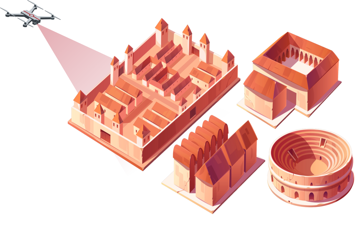
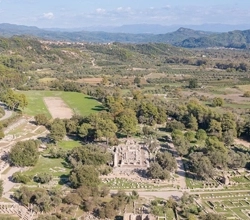
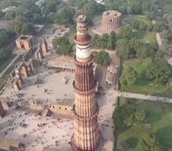
Utilizing state-of-the-art drones equipped with high-resolution cameras, we conduct detailed aerial surveys of archaeological sites. Our mapping services provide comprehensive visual documentation and precise topographical data, allowing for accurate analysis and interpretation.
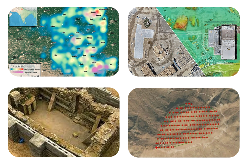
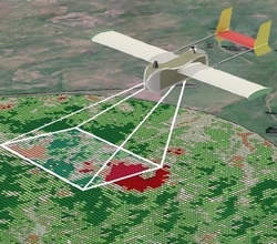
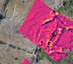
We offer advanced imaging capabilities such as LiDAR and thermal imaging to uncover hidden archaeological features. LiDAR technology creates highly accurate 3D maps of terrain, revealing buried structures and landscapes obscured by vegetation or soil cover. Thermal imaging detects temperature variations indicative of subsurface anomalies, aiding in the identification of archaeological targets.
Prior to excavation, we assist archaeologists in planning and strategizing through detailed analysis of aerial imagery and 3D models. Our drones provide real-time aerial footage during excavation activities, guiding ground crews and ensuring precision in documentation and data collection.
With expertise in navigating diverse environments, our drones are equipped to access remote or inaccessible archaeological sites. Whether in dense forests, rugged mountains, or harsh deserts, we provide safe and efficient aerial surveying solutions, minimizing environmental impact and maximizing data collection efficiency.
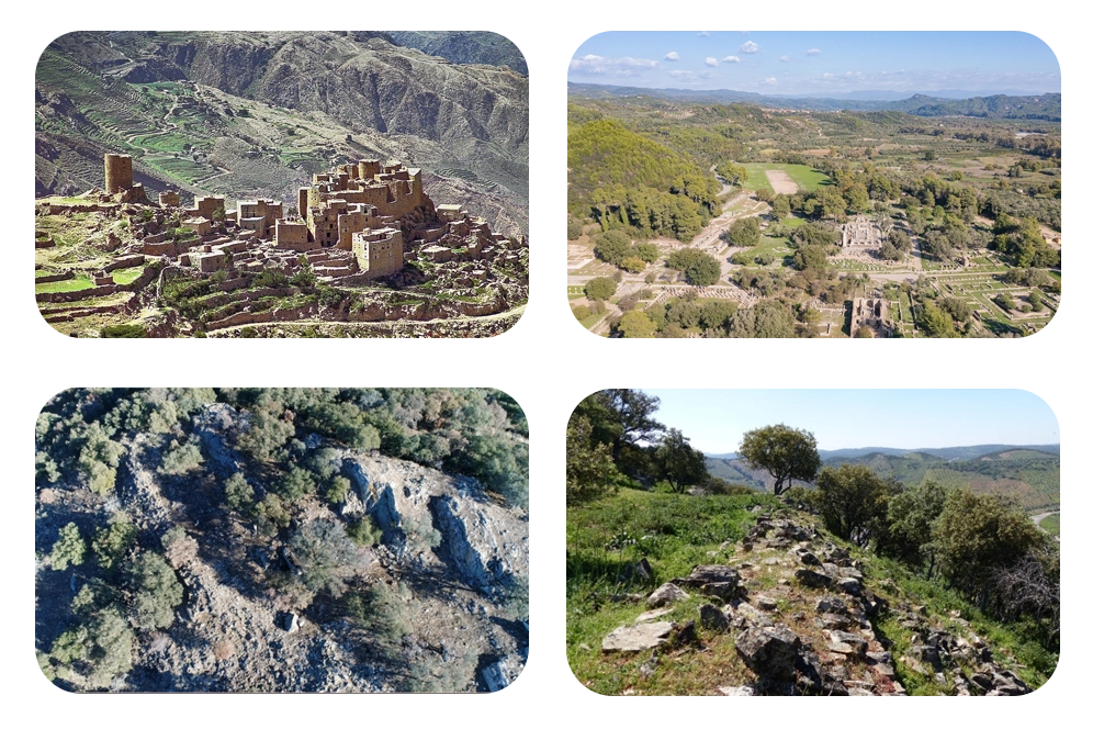
Our services deliver high-resolution aerial photographs, encompassing the entirety of archaeological sites from diverse perspectives. These detailed images offer comprehensive visual documentation, meticulously capturing the site's features, structures, and the surrounding landscape. Through our imagery, archaeologists gain invaluable insights into the site's layout and context, facilitating thorough analysis and interpretation for a deeper understanding of its significance.
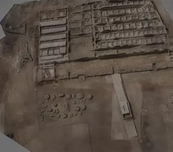
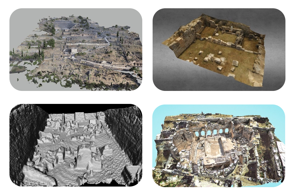
We create orthomosaic maps by stitching together hundreds or thousands of individual aerial images, eliminating distortions for accurate representation of site terrain and features. These maps are invaluable for precise measurement, planning, and analysis purposes in archaeology. By providing geometrically corrected visuals, orthomosaics enhance understanding and facilitate meticulous exploration and management of archaeological sites.
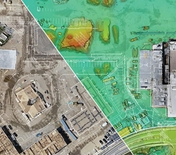
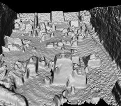
Topographical Data Digital Elevation Models (DEMs) and Digital Terrain Models (DTMs) are generated from aerial survey data. DEMs represent ground surface elevation, while DTMs include features like buildings and vegetation. These topographical datasets facilitate terrain analysis, slope calculation, and hydrological modeling, empowering researchers with essential insights for comprehensive understanding and management of archaeological sites.
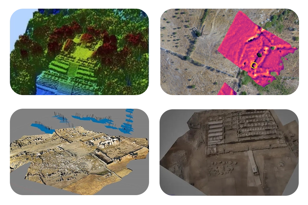
Utilizing aerial survey data, we craft detailed three-dimensional models of archaeological sites, offering immersive exploration and analysis experiences. These models provide virtual representations of sites, showcasing features like elevation changes, structures, and landscape characteristics. By facilitating spatial understanding, our 3D models enrich archaeological research, enabling researchers to delve deeper into the complexities of historical landscapes and structures.
Our services produce highly accurate 3D maps of terrain, showcasing surface features and anomalies. These detailed visualizations reveal buried structures, landscapes, and obscured archaeological features beneath vegetation or soil cover. By offering comprehensive insights into the site's topography, our 3D maps empower archaeologists with invaluable tools for uncovering hidden historical treasures and understanding the complex dynamics of archaeological landscapes.
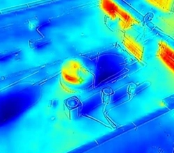
We conduct analysis of temperature variations across archaeological sites, pinpointing subsurface anomalies indicative of potential archaeological features. By identifying temperature differences, we highlight potential targets for further investigation, aiding in the discovery of buried structures or artifacts. This thermal analysis offers valuable insights into the site's hidden treasures, guiding archaeological exploration and enhancing the understanding of past civilizations.
We provide high-quality aerial photographs and videos, capturing site conditions, erosion patterns, and instances of looting or encroachment. Additionally, our services offer live or recorded aerial footage during excavation activities, ensuring precision in documentation and data collection. This real-time monitoring enhances on-site coordination and decision-making, facilitating thorough archaeological exploration while safeguarding against potential threats to site integrity.
We offer routinely updated reports cataloging observations from surveillance flights over archaeological sites. These reports meticulously document any changes detected, ensuring timely awareness of alterations in site conditions, potential risks, and significant developments, facilitating proactive management and preservation efforts.
Our drones offer unparalleled accuracy in mapping archaeological sites, identifying buried structures, and detailing ancient landscapes.
Drones cover vast areas swiftly, providing comprehensive data sets without extensive fieldwork, saving time and resources.
Our high-resolution drones gather data without disturbing delicate sites, preserving cultural heritage for future study.
Advanced tools extract insights from drone data, aiding researchers in uncovering hidden historical patterns and understanding site histories.