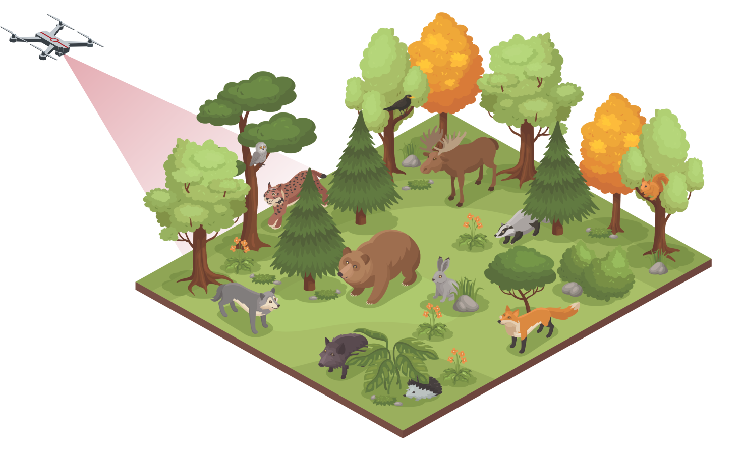
Wildlife
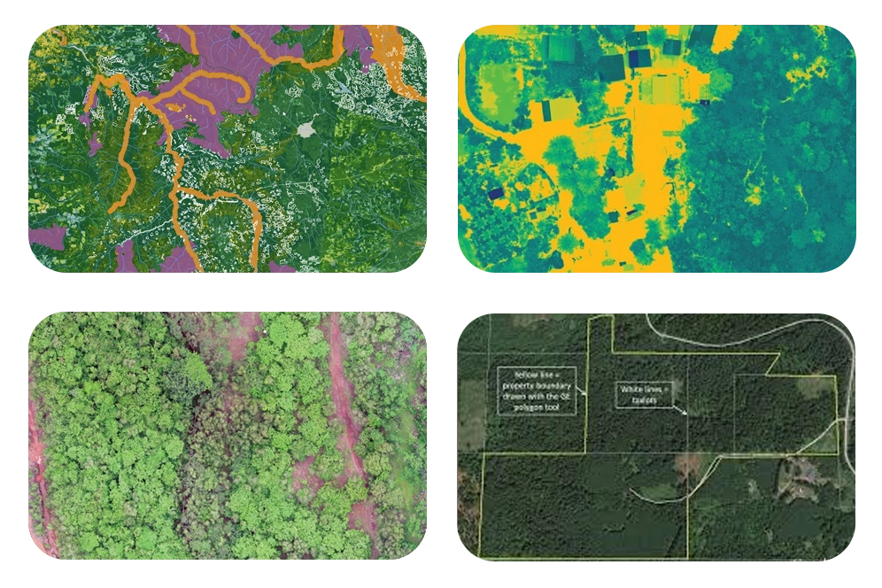
Drones can be used to create detailed maps of forested areas. Our services equipped with cameras and other sensors can collect high-resolution imagery, providing data to create detailed maps of the forest. These maps can be used for various purposes, such as monitoring changes in the forest over time, identifying areas of deforestation or illegal logging, and conducting research on the health and growth of the trees.
Topographic survey & boundary definitionUtilizing drones for topographical surveys enables rapid and precise mapping of land contours, elevations, and terrain features. High-resolution imagery and LiDAR data captured by drones facilitate accurate boundary demarcation and property delineation. This technology offers cost-effective and efficient alternatives to traditional surveying methods, reducing time and resource requirements. Detailed topographical data obtained from drone surveys aids in land development, infrastructure planning, and environmental management projects. Overall, drones streamline topographical surveys and boundary demarcation processes, providing valuable geospatial information for various applications.
Forest health mappingDrones with high-resolution and thermal cameras can be used to closely evaluate individual trees for signs of disease or damage. This can help forest managers identify and handle possible issues before they spread. This information can then be used to create plans for preserving and increasing tree health, ultimately contributing to the preservation and protection of forest ecosystems.
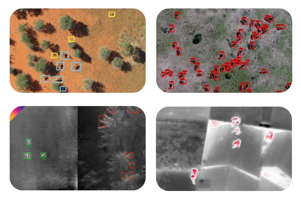
Drones can be used to monitor wildlife in forested areas, allowing researchers to see animal movements and behaviour without bothering them. This can provide crucial information about the health and well-being of many species. A drone allows researchers to acquire a bird's-eye perspective of the landscape and track animal movements across a broad area.
This is particularly beneficial for investigating animals that are difficult to trace on foot. Drones can also be equipped with cameras and other sensors to collect data on the behaviour of animals, monitor species numbers, and detect movement patterns.
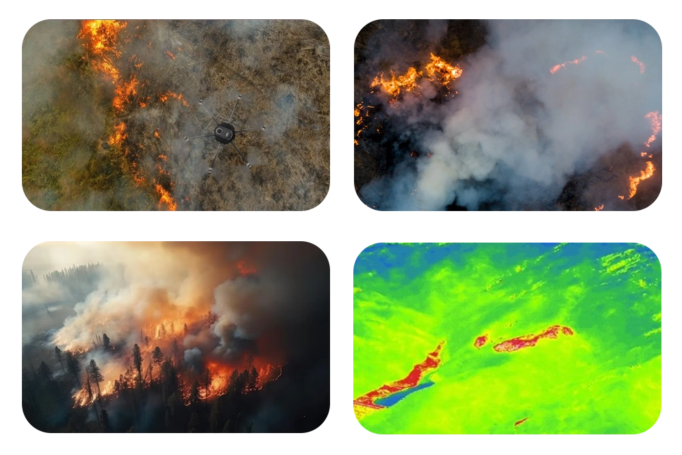
Drones coupled with thermal imaging cameras provide rapid response and important insights into forest fire detection and management. They can track the spread of fires, assess damage, and offer real-time data to ground-based firefighters. Drones help suppress fire outbreaks and reduce their impact on forest ecosystems.
Our drone technology enables precise monitoring and surveillance of wildlife habitats, allowing for accurate data collection on species distribution, behavior, and habitat health.
By utilizing drones, we minimize disturbance to sensitive ecosystems and wildlife populations. Our drones can observe from a distance without intruding, ensuring minimal impact on natural behaviors.
Our drones provide rapid response capabilities for wildlife emergencies such as natural disasters or animal distress situations. Equipped with live-feed cameras and thermal imaging, we can quickly locate and assess critical situations.
We offer data-driven conservation solutions by analyzing the information gathered by our drones. From population trends to habitat changes, our technology provides valuable insights for conservation planning and decision-making.